In and around Turnhout
-
Walking routes
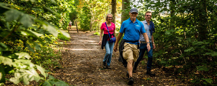 Walking to your hearts’ delight? It certainly works in the Turnhout Wetlands area. Stroll through 200 hectares of heather, meres and meadows. This unique nature reserve is home to rare plants and animals. Look at the splendour of the sundew and bend your ears to the chirping of the curlew. From the viewing hut you can see winged residents and the observation tower offers you a beautiful view of the Kleine en Grote Klotteraard (meres). Your dog is also welcome, as long as you keep him/her on a leash.
Don’t know where to start? Then let yourself be guided by the practical maps with walking routes. There are six routes available that divide the Wetlands area:
- Vensterwandeling (Window walk) 3.4 kilometres, starting point Klein Engelandhoeve
- Dombergheide (Domberg heathland) 3.6 kilometres, starting point Camping Baalse Hei
- Hondenwandeling (Dog walk) 4.6 kilometres, starting point Klein Engelandhoeve
- Hoge Heide (High Heath) 7.5 kilometres, starting point at network node number two at Steenweg op Baarle-Hertog 26
- Vennenwandeling (Meres walk) 7.7 kilometres, starting point Klein Engelandhoeve
- Kasteeltjes (Small Castles) 11.4 kilometres, starting point Klein Engelandhoeve
Practical information
The walking routes are available at Visit Turnhout.
Information about walking in the region can be found on the Kempen website.
-
Walking networks
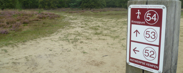
In addition to the walking routes, Turnhout also has a range of walking networks. With the help of the hiking network nodes you can map out numerous walking routes yourself. The numbered red and white signs always keep you on the right path. A super convenient system for both recreational and seasoned hikers. The following walking networks can be purchased at Visit Turnhout:
- de/the Merode
- Kempens Landgoed / Kempen Country Estate
- Kempense Heide / Kempen Heathland
- Kempense Heuvelrug / Kempen Ridge
- Kempense Hoven / Kempen Courts
- Kempense Landduinen / Kempen Land Dunes
- Kempense Kolonies / Kempen Colonies
- Kempense Meren / Kempen Lakes
- Kempense Beemden / Kempen Meadows
- Kempense Netevallei / Kempen Valley of the Nete
- In het Land van Stille Waters / In the Land of Silent Waters
- Rivierenland / River Land
- Wandelen in de Noordertuin van Antwerpen / Walking in the northern Antwerp garden
Would you like to know which route is in which area? Take a look at the Kempen website. Here you will find all maps with text and explanations included. Turnhout is already included on the Kempens Landgoed and Kempense Kolonies maps.
The hiking network maps can be bought for 8 euros at Visit Turnhout.
-
GPS walks
Can’t you get enough of walking? Then also try our GPS walks. In total there are seven different walks available. All you have to do is place the corresponding link into your GPS and you can start walking. The overview of the walks and the corresponding links can be found on the GPSwalking website.